UKUK USUSIndiaIndia

Every Question Helps You Learn

Join Us
Streak
Leading Streak Today 49
Your Streak Today 0
Streak
Leading Streak Today
49
Your Streak Today
0
OS Maps: Landscape Features
How many landscape features do you recognise?

OS Maps: Landscape Features

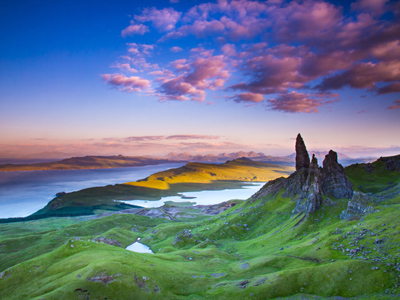
This GCSE Geography quiz takes a look at land features on Ordnance Survey maps. A map is a representation of part of the surface of the Earth and cartographers have developed many different ways of representing landscape features. Some of these are human made like villages, quarries and power lines, whilst others are natural - valleys, spurs, rivers etc. A lot of these features can be recognised from the symbols used to represent them but to spot others, you need to look closely at the contour lines.

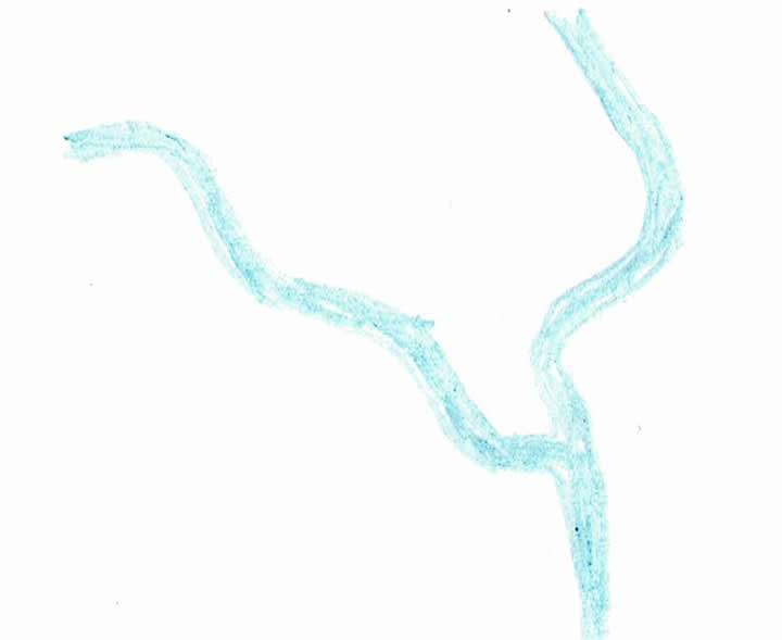
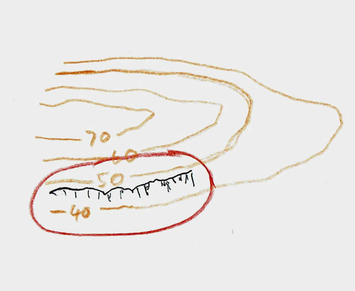
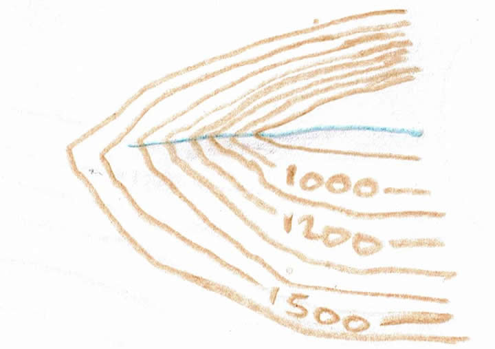
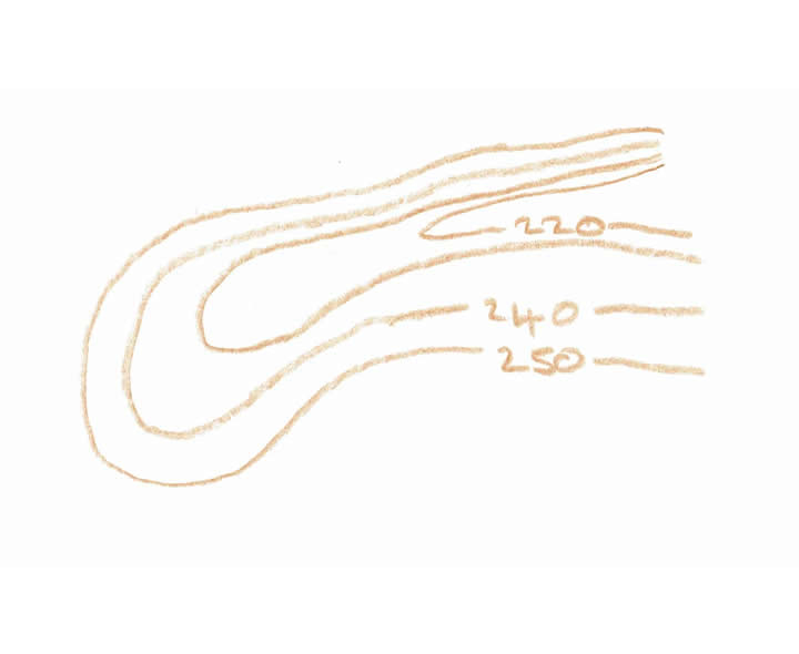
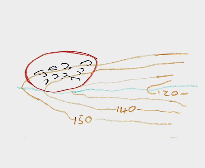
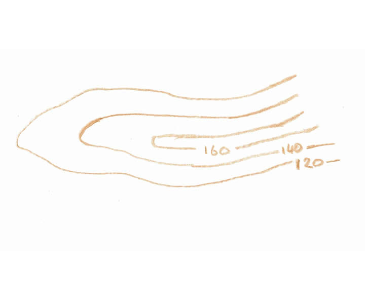
To recognise a valley, the contour lines form a pattern that is either a V shape or a U shape. Next, you need to look at the heights represented by the contour lines. If they get lower as you move away from the closed part of the V or U, then you have a valley. If there is a blue line running down the valley, it contains a stream, otherwise, you have a dry valley.

Spurs have the same pattern of contour lines as valleys, so this can make things a little tricky. To recognise a spur, look at the closed part of the V or U shape. If the altitude represented by the contour lines is lower towards the closed point of the V or U, then you have a spur. Any streams marked on the spur will leave down the sides and not along its length as a spur is high ground and water will always flow to a low point.

As well as recognising landscape features from an OS map, you could also be asked to identify their characteristics. You need to look closely for any clues, for example, a valley may have a cliff marked along one or both sides or there may be a coniferous woodland there. The closeness of the contour lines can help you as well - the closer they are together, the steeper the slope. Also, if a valley for example has a very wide and flat shape, the V or the U shape of the contour lines will be more difficult to see. With practice, you can soon become used to these ideas.

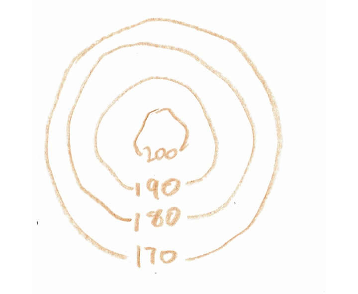
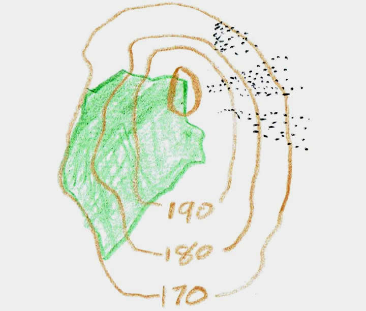
You can apply the same ideas to hills too. Look carefully at the contour lines that you are presented with in order to determine the shape and steepness of a hill. If the contours are a series of concentric circles or oval shapes, the hill will have uniform slopes all around. Most hills though will have parts that are steeper than others, noted where the contour lines are closer together than in other parts of the hill. If there are two hills together, the contours will show a col (saddle).

To see a larger image, click on the picture.
1.
A student preparing for fieldwork made several sketches of landscape features they expected to see. This sketch represents:
a fast-flowing mountain stream
the confluence of two rivers
a wave-cut platform
a road junction
Wide blue lines on OS maps represent rivers and where two rivers join is called a confluence
2.
What landscape feature would be seen in the area that is outlined in red on this sketch map?
River
Waterfall
Cliff
Ox-bow lake
This is only a small cliff, the contour lines indicate that it is less than 10m in height
3.
Which of the following statements is correct?
This diagram represents a frost shattered peak in a mountain range
This diagram represents an area where stone has been quarried
This diagram represents the lower course of a river
This diagram represents part of the upper course of a river
The clues are that the contour lines show very high ground, contour lines close together, the sharp V-shape of the contour lines and the thin blue line with no meanders showing the stream
4.
This pattern of contour lines shows:
a valley
an escarpment
a ridge
a conical shaped hill
The contours are uniformly spaced and more or less circular
5.
What landscape feature is represented by this sketch taken from an OS map?
Village
Woodland
Valley
Trunk road
Landscape features include human-made items too
6.
What landscape feature would you be looking at if you saw this pattern of contours on your OS map?
A meander
A spur
A hill
A valley
On OS maps, V-shaped patterns of the contour lines indicate there is a valley
7.
This sketch map was made by a geographer carrying out their fieldwork. What landscape feature would be seen in the area indicated by the red ring on the sketch?
Railway
Rocky outcrops
A vertical cliff
Moorland
The small black curves are used to indicate and area where there are a lot of surface rocks visible
8.
What landscape feature did the geographer see on the east side of the hill (north is at the top)?
A wave-cut platform
A cliff
An escarpment
Scree
A scree is a mass of angular unsorted rocks lying on a slope of a hill or mountain or at the base of a cliff. It can also be referred to as talus
9.
This landscape feature is a:
pyramidal peak
valley
spur
lake
V-shaped patterns of contour lines indicate spurs or valleys, in this case, the height is lower towards the point of the V-shape therefore it is a spur
10.
This sketch map was prepared for a 1:50,000 scale OS map. The green area on it shows:
a mixed woodland
a broadleafed woodland
an orchard
a field
Broadleafed woodland would have small broadleaf trees drawn on it, a conifer woodland would have small pine trees drawn on it. An area of plain green on an OS 1:50,000 map indicates a mixed woodland with both conifers and broadleafed trees
You can find more about this topic by visiting BBC Bitesize - Cartographic skills

Author:  Kev Woodward

© Copyright 2016-2024 - Education Quizzes
Work Innovate Ltd - Design | Development | Marketing