


Ask the AI Tutor
Need help with Maps - Colours and Symbols? Ask our AI Tutor!
AI Tutor - Lucy
Connecting with Tutor...
Please wait while we establish connection
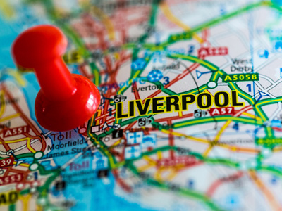
Could you find where you live on a map of the British Isles?
Maps - Colours and Symbols
Maps use colours and symbols to show important information. This quiz helps you practise reading simple map keys so you can quickly find places and paths.
1 .
What colour are rivers on maps?
Red
Green
Yellow
Blue
Lakes, seas and oceans are also coloured blue
2 .
What colour are forests on maps?
Red
Green
Yellow
Blue
Why do you think woods and forests are coloured green on maps?
3 .
Sam is looking at a map of his town. He sees a small black cross on the map (+). What does this symbol mean?
Railway station
Shop
Church
Bus station
Chapels, temples, mosques, and synagogues are also marked on maps
4 .
There are two big churches in Sam’s town. Sam looks at a map of the town. One of the churches is marked by a black square with a cross on top of it. What does the church have?
A tower
A lift
A moat
A spire
The church has a tower. A lot of church towers have bells and a clock
5 .
Sam looks again at the map of his town. The other big church is shown as a black circle with a cross on the top. What does this church have?
A lift
An escalator
A spire
A draw-bridge
This church has a spire. What shape is a spire?
6 .
Sam finds the railway station on the map. The symbol for the railway station is a ___ circle.
Red
Green
Blue
Purple
Red is an easy colour to spot
7 .
What colour are railway lines on maps?
Green
Blue
Black
Purple
Nearly all railway lines are coloured black on maps
8 .
Sam looks at a globe. He knows the Antarctic is covered in snow and ice. What colour is the Antarctic on the globe?
Red
Green
Black
White
Greenland is a very big island. It is nearly all covered in ice and snow. Can you find Greenland on a globe or in an atlas?
9 .
Sam is looking at a map of his town. He sees a building marked Sch. What does Sch. stand for?
Scheme
School
Schooner
Schedule
What does Univ. stand for on maps?
10 .
Sam lives not far from the M6 motorway. He looks at a map of the roads in his part of England. What colour is the motorway on the map?
Red
Green
Blue
Yellow
Can you find all the motorways on a map of Britain and Ireland?


**Unlimited Quizzes Await You! 🚀**
Hey there, quiz champ! 🌟 You've already tackled today's free questions.
Ready for more?
Ready for more?
🔓 Unlock UNLIMITED Quizzes and challenge yourself every day. But that's
not all...
not all...
🔥 As a Subscriber you can join our thrilling "Daily Streak" against other
quizzers. Try to win a coveted spot on our Hall of Fame Page.
quizzers. Try to win a coveted spot on our Hall of Fame Page.
Don't miss out! Join us now and keep the fun rolling. 🎉
**Unlimited Quizzes Await You! 🚀**
Hey there, quiz champ! 🌟 You've already tackled today's free questions. Ready for more?
🔓 Unlock UNLIMITED Quizzes and challenge yourself every day. But that's not all...
🔥 As a Subscriber you can join our thrilling "Daily Streak" against other quizzers. Try to win a coveted spot on our Hall of Fame Page.
Don't miss out! Join us now and keep the fun rolling. 🎉
© Copyright 2016-2026 - Education Quizzes
Work Innovate Ltd - Design | Development |
Marketing