


Ask the AI Tutor
Need help with Scout Quiz - Orienteering & Wilderness Navigation? Ask our AI Tutor!
AI Tutor - Lucy
Connecting with Tutor...
Please wait while we establish connection
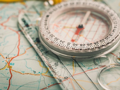
Compasses are one of the most reliable tools for navigation.
Scout Quiz - Orienteering & Wilderness Navigation
Orienteering mixes maps, compasses, and careful thinking. Try this quiz to practise finding directions, planning routes, and staying safe outdoors when you are exploring new places.
1 .
What is the primary purpose of a topographic map in orienteering?
To display weather conditions
To indicate the location of wildlife
To show elevation and terrain features
To list emergency contact numbers
Topographic maps provide crucial details about the landscape, helping orienteers assess elevation changes and terrain characteristics.
2 .
In orienteering, what does the term "bearing" refer to?
The angle between your current location and the destination
A type of wild animal found in the wilderness
The number of steps you take per minute
A type of trail marker
Bearings help you determine the direction you need to travel to reach your destination accurately.
3 .
Which of these tools is essential for precise map reading and navigation in orienteering?
Flashlight
Smartphone
Whistle
Compass
A compass is a vital tool for orienteering, helping you align your map with the real world and find your way accurately.
4 .
What does the acronym "GPS" stand for in the context of wilderness navigation?
Global Positioning System
Global Positioning Service
Ground Positioning System
Geographic Pointing Service
GPS provides precise location information using satellites, enhancing navigation in the wilderness.
5 .
Which colour is typically used for depicting water features on topographic maps?
Green
Blue
Red
Yellow
Water features like rivers, lakes, and streams are commonly shown in blue on topographic maps.
6 .
What should you do if you become disorientated while hiking in the wilderness?
Panic and start running in any direction
Climb a tall tree to get a better view
Stay calm, retrace your steps, and use your map and compass to find your way
Yell loudly for help
Panic won't help. Stay calm, retrace your path, and rely on your orienteering skills to regain your bearings.
7 .
In orienteering, what does the term "triangulation" involve?
Creating a triangle shape with your hiking group
Measuring the temperature to assess weather conditions
Using a whistle to signal for help
Determining your location by taking bearings to two or more known points
Triangulation is a technique used to pinpoint your location accurately by taking bearings from multiple known points.
8 .
What is a contour line on a topographic map used to represent?
A path for hiking
Changes in elevation
The distance to the nearest water source
The location of wildlife
Contour lines depict changes in elevation, helping orienteers understand the terrain's ups and downs.
9 .
When using a compass to find your way, which direction does the needle point to?
North
South
East
West
The compass needle typically points north, providing a reference direction for navigation.
10 .
What is the main advantage of using a map and compass for navigation over GPS technology?
GPS devices are easier to carry.
Maps and compasses are more reliable in all weather conditions.
Maps and compasses provide real-time weather updates.
GPS devices are more accurate.
Maps and compasses are more reliable in all weather conditions.


**Unlimited Quizzes Await You! 🚀**
Hey there, quiz champ! 🌟 You've already tackled today's free questions.
Ready for more?
Ready for more?
🔓 Unlock UNLIMITED Quizzes and challenge yourself every day. But that's
not all...
not all...
🔥 As a Subscriber you can join our thrilling "Daily Streak" against other
quizzers. Try to win a coveted spot on our Hall of Fame Page.
quizzers. Try to win a coveted spot on our Hall of Fame Page.
Don't miss out! Join us now and keep the fun rolling. 🎉
**Unlimited Quizzes Await You! 🚀**
Hey there, quiz champ! 🌟 You've already tackled today's free questions. Ready for more?
🔓 Unlock UNLIMITED Quizzes and challenge yourself every day. But that's not all...
🔥 As a Subscriber you can join our thrilling "Daily Streak" against other quizzers. Try to win a coveted spot on our Hall of Fame Page.
Don't miss out! Join us now and keep the fun rolling. 🎉
© Copyright 2016-2026 - Education Quizzes
Work Innovate Ltd - Design | Development |
Marketing