


Ask the AI Tutor
Need help with Characterisation of Rural Areas? Ask our AI Tutor!
AI Tutor - Lucy
Connecting with Tutor...
Please wait while we establish connection
See if you can get 10 out of 10 in this quiz.
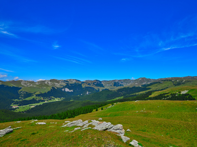
Characterisation of Rural Areas
What makes the countryside different from towns and cities? This GCSE Geography quiz explores how rural areas look, feel, and function.
1 .
Which of the following best describes a rural area?
Farmland
An area of low population density
Housing is isolated or contained in villages and hamlets
All of the above
It is quite difficult to define a rural area in a few words as there are several different types, each with its own characteristics
2 .
In which of the following areas is tourism most likely to make a significant contribution to the local economy?
Rural/urban fringe
Commuter belt
Accessible rural
Remote rural
Accessible rural and remote rural both have the characteristics that attract tourists, however, remote rural areas usually have fewer places like camp sites, hotels and B&Bs where people can stay
3 .
Which of the following has had a significant effect on primary employment in rural areas?
Mechanisation of agriculture
Reduced need for food
Lack of a skilled workforce
New housing
Mechanisation of agriculture means that farms can be run using fewer people, reducing the availability of primary employment in rural areas
4 .
Rural areas change over time. Three of the reasons are income from tourism, the profitability of farming and the development of new industries in the area. These are known as ...
economic factors
environmental factors
sociable factors
social factors
Economic factors have a significant influence on migration to urban centres
5 .
In which of the rural areas are you most likely not to have a mobile phone signal?
Rural/urban fringe
Commuter belt
Accessible rural
Remote rural
There are places in all areas where you may not get a signal, however, because the population density of remote rural areas is the lowest in the country, mobile phone operators do not believe it is economic to provide a service. Obtaining planning permission is difficult as the areas are often environmentally sensitive and transporting materials to a remote site is expensive
6 .
If you passed through a village with expensive houses and a train station, which type of rural area are you most likely to be in?
Rural/urban fringe
Commuter belt
Accessible
Remote
Good communications (e.g. rail link) and expensive housing stock are key characteristics of commuter belts
7 .
Which of the following statements is not true?
The population density is usually the lowest in remote rural areas
Farming and tourism is important to the economy of all rural areas
Commuter belts have good communications to urban centres
The main type of farming in remote rural areas is arable
In the UK, most of the remote rural areas are hilly or mountainous where arable farming is not possible
8 .
In an accessible rural area ...
farming is important to the economy
farming is not as important as heavy industry
housing is extremely expensive
there are a large number of primary routes and main roads linking the settlements
Primary routes and main roads may cross the area but have not been built specifically to link settlements. This makes the rural area accessible
9 .
Which of the following is not false?
Large numbers of people migrate from the urban/rural fringe to the commuter belt
The distance of the rural area from an urban centre determines how it is classified
The population of rural areas is increasing
In order to avoid depopulation, rural areas need to develop sustainable businesses
The general trend for rural areas is towards depopulation because there is little or no local work for people
10 .
In a rural/urban fringe ...
the most likely development is on brownfield sites
the most likely development is on greenfield sites
the most likely development is on greyfield sites
no new development is permitted
The area where no new development is permitted is green belt land. In practice, because of the need for new housing, some development does take place


**Unlimited Quizzes Await You! 🚀**
Hey there, quiz champ! 🌟 You've already tackled today's free questions.
Ready for more?
Ready for more?
🔓 Unlock UNLIMITED Quizzes and challenge yourself every day. But that's
not all...
not all...
🔥 As a Subscriber you can join our thrilling "Daily Streak" against other
quizzers. Try to win a coveted spot on our Hall of Fame Page.
quizzers. Try to win a coveted spot on our Hall of Fame Page.
Don't miss out! Join us now and keep the fun rolling. 🎉
**Unlimited Quizzes Await You! 🚀**
Hey there, quiz champ! 🌟 You've already tackled today's free questions. Ready for more?
🔓 Unlock UNLIMITED Quizzes and challenge yourself every day. But that's not all...
🔥 As a Subscriber you can join our thrilling "Daily Streak" against other quizzers. Try to win a coveted spot on our Hall of Fame Page.
Don't miss out! Join us now and keep the fun rolling. 🎉
© Copyright 2016-2026 - Education Quizzes
Work Innovate Ltd - Design | Development |
Marketing