


Ask the AI Tutor
Need help with Maps? Ask our AI Tutor!
AI Tutor - Lucy
Connecting with Tutor...
Please wait while we establish connection
Can you read a map?
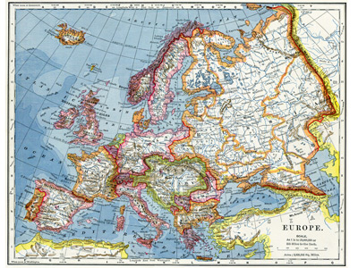
Maps
Maps help geographers see patterns, distances, and places clearly. This GCSE Geography quiz checks your skills using different map types, scales, and symbols.
1 .
Which of the following statements about grid references is true?
A four-figure grid reference gives the location of an exact point on the map
A four-figure grid reference gives the location of the grid cell directly below
A six-figure grid reference gives the location of an exact point on the map
A six-figure grid reference gives the location of the grid cell directly below
A four-figure grid reference gives the grid square to the north and east of itself
2 .
Where the contours are very close together it indicates ...
a steep slope
flat ground
a valley
the top of a hill or mountain
Where the contours are close together, it means there is a lot of difference in height in a short distance
3 .
There are several different types of road shown on OS 1:50,000 maps. Which of the following sequences represents the colours used for motorways, main roads and tarred minor roads in that order?
Red, white, blue
White, red, blue
Blue, red, yellow
Blue, yellow, red
Primary routes are coloured green, you will sometimes hear these called 'trunk roads'.
4 .
What area is represented by the smallest single grid cell on OS maps?
10 km2
1 km2
500 km2
2 km2
This is the size of the smallest grid cell on a 1:50,000 OS map
5 .
On an OS map, you will see numerous wiggly brown lines, some have numbers printed alongside them. What are these lines called and what are the numbers?
Roads, distance from London
Isotherms, average winter temperature
Isobars, atmospheric pressure
Contours, height above sea level
The height above sea level is only approximate. It is very difficult to measure sea level as it changes with the tides
6 .
The Ordnance Survey was first established in the late 18th century. Why?
To produce maps for King George III
To improve military logistics
So that hikers could avoid trespassing on private property
So the postal service could deliver letters
In military terms, logistics is a word that means moving materials and forces from one place to another
7 .
When giving any grid reference, which is the correct order?
Eastings then northings
Northings then eastings
Westings then southings followed by the eastings
Eastings first, then southings, then northings and finally the westings
It is the same idea as using coordinates in your maths lessons, the x value first followed by the y value
8 .
Which of the following map scales is the largest?
1:50,000
1:20,000
1 cm to 2 km
2 cm to 1 km
The first and the last option are the same scale, the third answer is a much smaller scale. 1:20,000 means that 1 cm represents just 200 metres on the ground and is therefore the map with the largest scale.
9 .
What colour is usually used on OS 1:50,000 maps for tourist information?
Pale blue
Pale yellow
Light grey
Light brown
Ordnance Survey 1:50,000 scale maps use about 140 symbols which are gradually updated as the lanscape and local amenities change
10 .
A cartographer is a person who ...
makes carts
is an expert at doing gymnastic cartwheels
is involved in making maps
drives a horse and cart
The first cartographers worked on their own and with very limited surveying equipment so maps were not particularly accurate


**Unlimited Quizzes Await You! 🚀**
Hey there, quiz champ! 🌟 You've already tackled today's free questions.
Ready for more?
Ready for more?
🔓 Unlock UNLIMITED Quizzes and challenge yourself every day. But that's
not all...
not all...
🔥 As a Subscriber you can join our thrilling "Daily Streak" against other
quizzers. Try to win a coveted spot on our Hall of Fame Page.
quizzers. Try to win a coveted spot on our Hall of Fame Page.
Don't miss out! Join us now and keep the fun rolling. 🎉
**Unlimited Quizzes Await You! 🚀**
Hey there, quiz champ! 🌟 You've already tackled today's free questions. Ready for more?
🔓 Unlock UNLIMITED Quizzes and challenge yourself every day. But that's not all...
🔥 As a Subscriber you can join our thrilling "Daily Streak" against other quizzers. Try to win a coveted spot on our Hall of Fame Page.
Don't miss out! Join us now and keep the fun rolling. 🎉
© Copyright 2016-2026 - Education Quizzes
Work Innovate Ltd - Design | Development |
Marketing