


Ask the AI Tutor
Need help with OS Maps: Symbols? Ask our AI Tutor!
AI Tutor - Lucy
Connecting with Tutor...
Please wait while we establish connection
Challenge yourself in this fun quiz.
OS Maps: Symbols
OS map symbols turn real landscapes into simple pictures. Learn how to recognise roads, rivers, buildings, and relief features so you can read detailed maps with confidence.
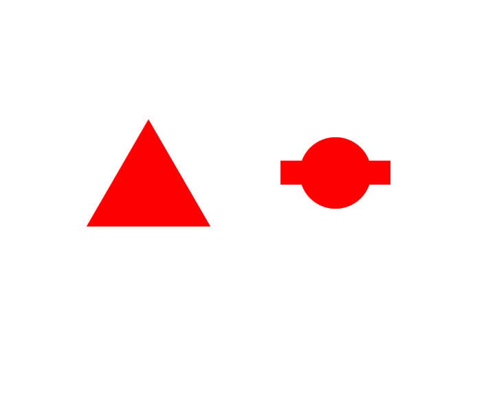
1 .
What type of trees would you see if you visited this woodland?
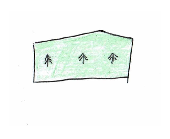
Coniferous
Deciduous or broadleafed
Apple or pear
A mixture of coniferous and deciduous
Broadleaf woodland has little conventional tree drawings in it, orchards are a grid of green dots and mixed woodland has no little drawings of trees - it is just green
2 .
What commercial activity would take place (or has taken place at some time in the past) at the location indicated by this map symbol?
Shopping
Balloon manufacture
Quarrying
Sailing
This symbol indicates a quarry from which rock is (or has been at some time in the past) extracted. There are separate symbols for gravel quarrying and sand quarrying
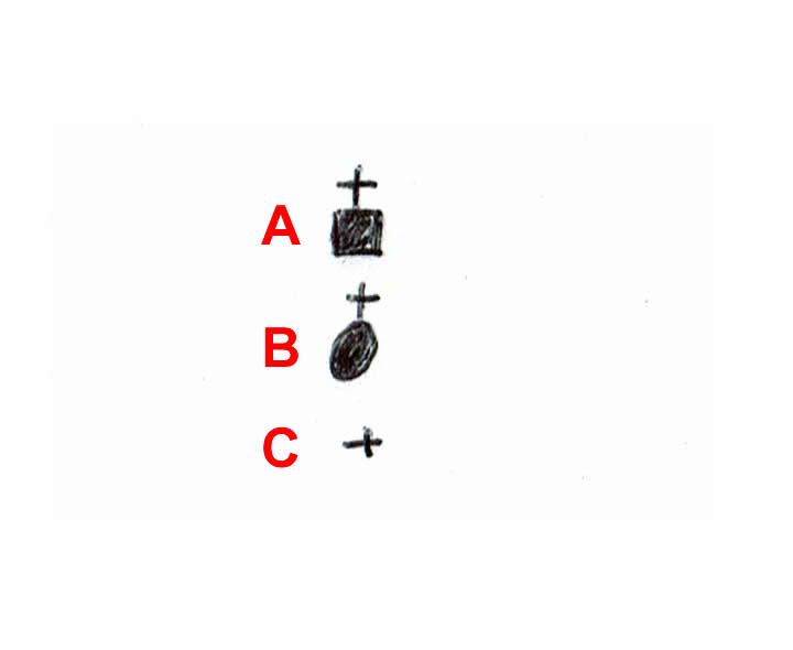
3 .
Which of the sketched symbols represents an unfenced secondary road?
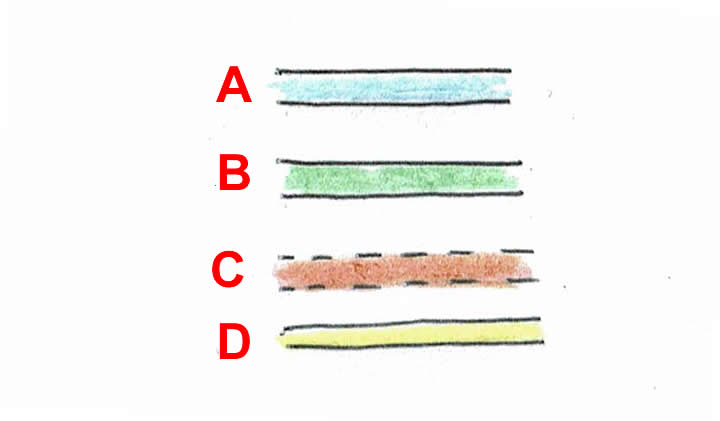
A
B
C
D
Even if you didn't know that the orange-brown colour meant a secondary road, you can tell that C was the answer as it is the only one that shows it is unfenced (dotted lines at the edges instead of unbroken lines)
4 .
Which of the following is most likely to be interested in both of these two OS map symbols?
A backpacker
A motorist
A commuter
A cyclist
Just in case you are not sure what a backpacker is, it is someone who is travelling on foot or by public transport using a rucksack (backpack) to carry their belongings. The symbols represent a youth hostel and a bus or coach station. The other three types of person may be interested in one or the other of the two locations, but it is a backpacker who is most likely to be interested in both at the same time. One is their means of transport and the other is where they will find a bed for the night
5 .
What does this symbol indicate?
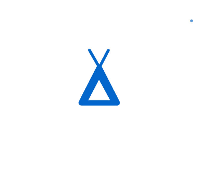
A place where you can hire a teepee for your holiday
A campsite
A hippy colony
A caravan site
This symbol indicates that the campsite is intended for tents only, if the site takes caravans as well, there will be a small blue caravan symbol with it
6 .
This symbol was added to a map by a student carrying out some fieldwork. Which of the following structures had they seen?
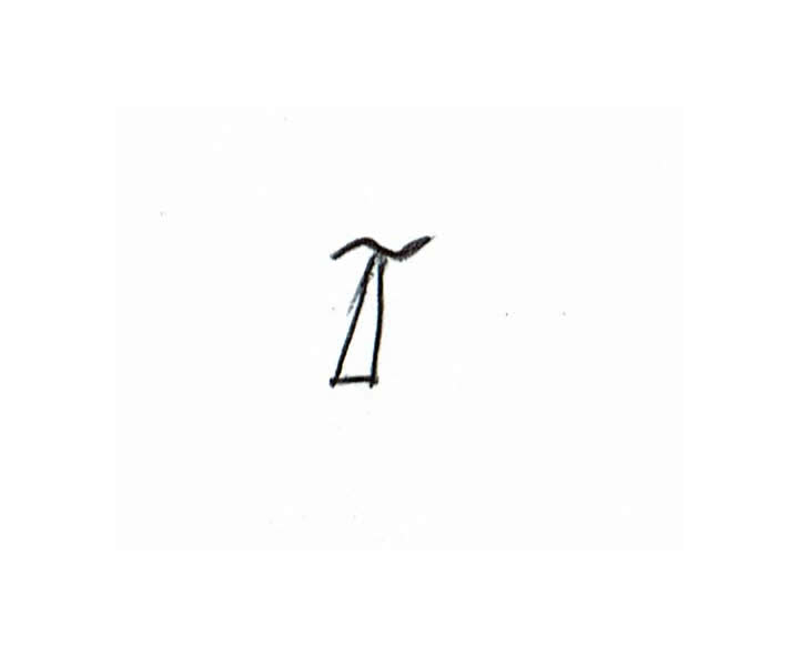
TV transmission mast
Mobile phone network mast
TV signal booster mast
It could have been any of the above
The wavy line indicates some sort of electromagnetic radiation and the triangle represents the mast itself
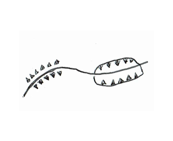
7 .
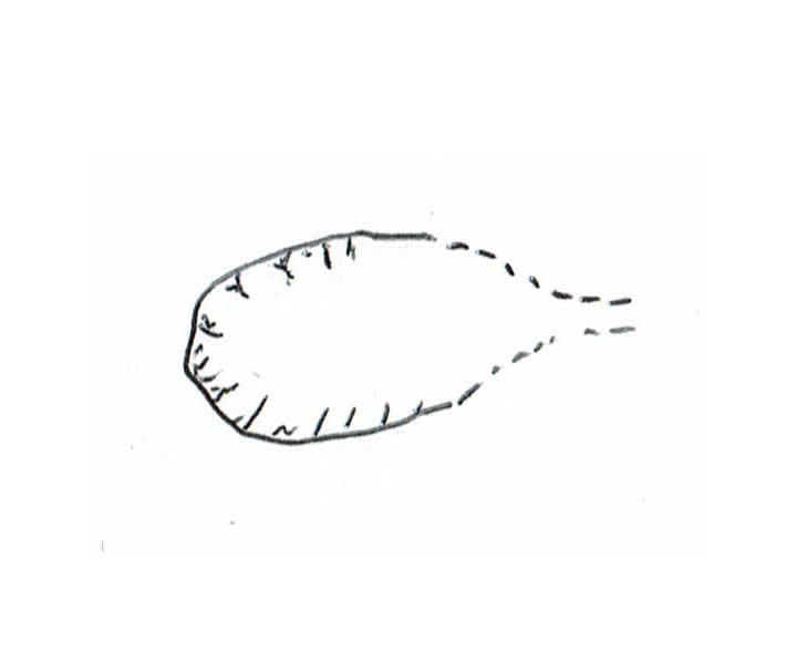
Where would you find the features depicted in this sketch map?
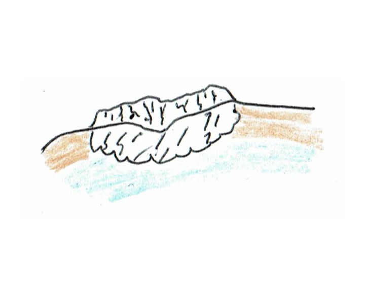
In a mountain range
In the CBD of an urban area
On a subsistence farm
At the coast
The junction between the blue and the pale brown indicates the low water mark of the sea, the black line is the high water mark. Also shown is a wave cut platform, cliff and beach
8 .
Which of the following is NOT true?
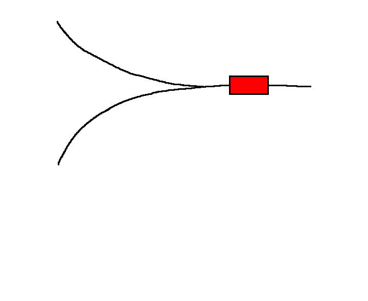
This diagram represents part of the railway network
This diagram shows a railway junction
This diagram shows a railway station
This diagram shows a light rapid transit system
The red rectangular symbol indicates a principal station
9 .
A group of students were drawing a sketch map of a village as part of their fieldwork. One of the buildings was used as a place of worship. Which of the symbols should they use to represent it?
A
B
C
More information is required
You need to know if the building has a tower, spire, minaret, dome or none of these features before you can decide on the correct answer
10 .
The sketch shows:
a railway line with an embankment and a cutting
a railway line with an embankment and a walled embankment
a canal going through a cutting and over an aqueduct
a series of locks on a canal
Water features in the landscape are represented in blue so that immediately rules out options three and four


**Unlimited Quizzes Await You! 🚀**
Hey there, quiz champ! 🌟 You've already tackled today's free questions.
Ready for more?
Ready for more?
🔓 Unlock UNLIMITED Quizzes and challenge yourself every day. But that's
not all...
not all...
🔥 As a Subscriber you can join our thrilling "Daily Streak" against other
quizzers. Try to win a coveted spot on our Hall of Fame Page.
quizzers. Try to win a coveted spot on our Hall of Fame Page.
Don't miss out! Join us now and keep the fun rolling. 🎉
**Unlimited Quizzes Await You! 🚀**
Hey there, quiz champ! 🌟 You've already tackled today's free questions. Ready for more?
🔓 Unlock UNLIMITED Quizzes and challenge yourself every day. But that's not all...
🔥 As a Subscriber you can join our thrilling "Daily Streak" against other quizzers. Try to win a coveted spot on our Hall of Fame Page.
Don't miss out! Join us now and keep the fun rolling. 🎉
© Copyright 2016-2026 - Education Quizzes
Work Innovate Ltd - Design | Development |
Marketing