


Ask the AI Tutor
Need help with Weather Forecasting? Ask our AI Tutor!
AI Tutor - Lucy
Connecting with Tutor...
Please wait while we establish connection
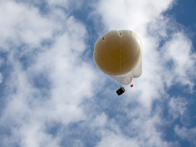
Weather balloons are one of the tools used by forecasters.
Weather Forecasting
This GCSE Geography quiz on weather forecasting explores how meteorologists collect data, use supercomputers, and create forecasts that help people plan everyday activities and prepare for extreme weather.
1 .
Which of the following are not normally forecasted by the Met Office?
Pollen
Precipitation
Windspeed
River levels
River levels are commonly forecasted by the environment agency
2 .
Lines of equal atmospheric pressure on a weather map or a synoptic chart are known as what?
Isobars
Cold Fronts
Warm Fronts
Isolines
Air pressure tends to range between 890mb and 1060mb
3 .
Which of the following professions and industries are not offered specialist training by the Met Office?
Marine industries
Rail industries
Renewable energy specialists
Teachers
PIlots, road operators, water management industries, broadcasters, retail operators and climate change scientists are also offered training in weather forecasting and how to react to the changing conditions. Teachers just have to read the forecast themselves and make the best of it!
4 .
A synoptic chart summarises atmospheric conditions. Which of the following is not commonly shown on a synoptic chart?
Temperature
Sea state
Precipitation
Atmospheric pressure
Synoptic charts commonly show temperature, precipitation, wind speed and direction, atmospheric pressure and cloud coverage
5 .
How can ocean waves be predicted and forecasted?
Ocean waves are generated thousands of miles away and can be tracked
Ocean waves are generated by the sea floor geology which has been modelled
Ocean waves are driven by wind power and wind strength and direction can be predicted
Ocean waves are driven only by storms in the middle of the ocean which can be mapped and predicted
Ocean waves are driven by wind power. Sometimes the wind may have been driving the waves for hundreds, or in the Southern Ocean thousands, of miles
6 .
What is an anticyclone more commonly known as?
High Pressure
Low Pressure
A hurricane
A typhoon
When anticyclones form in the summer we get warm, sunny and dry weather. During the winter the same conditions can be sunny, but extremely cold
7 .
What is atmospheric or barometric pressure measured in?
Pounds per square inch (PSI)
Kilograms (kg)
Pascals (Pa)
Millibars (mb)
Atmospheric pressure is created by the weight of the air above us and is the amount of force it exerts downwards per square metre
8 .
Which of the following is not used in forecasting?
Moisture content in the oceans
Cloud cover and cloud types
Moisture content in the atmosphere
Atmospheric pressure
The moisture content in the oceans is always 100%! The temperature of the oceans is measured though, as are the ocean currents
9 .
Low pressure and tight isobars tend to lead to what sort of weather?
Hot and sunny
Dry and windy
Wet and windy
Wet and calm
In low pressure areas, water vapour rises, cools and condenses as precipitation, while tight isobars mean that the pressure is changing rapidly, leading to a greater wind speed
10 .
A radiosonde measures atmospheric parameters and transmits them to a receiver on the ground. What are radiosondes normally attached to?
Weather balloons
Surface monitoring buoys
Land stations
Ship based monitoring
You may not have heard of a radiosonde but the question gives you some more clues. It hints at the idea that the radiosonde is above the ground, so it must be attached to a weather balloon


**Unlimited Quizzes Await You! 🚀**
Hey there, quiz champ! 🌟 You've already tackled today's free questions.
Ready for more?
Ready for more?
🔓 Unlock UNLIMITED Quizzes and challenge yourself every day. But that's
not all...
not all...
🔥 As a Subscriber you can join our thrilling "Daily Streak" against other
quizzers. Try to win a coveted spot on our Hall of Fame Page.
quizzers. Try to win a coveted spot on our Hall of Fame Page.
Don't miss out! Join us now and keep the fun rolling. 🎉
**Unlimited Quizzes Await You! 🚀**
Hey there, quiz champ! 🌟 You've already tackled today's free questions. Ready for more?
🔓 Unlock UNLIMITED Quizzes and challenge yourself every day. But that's not all...
🔥 As a Subscriber you can join our thrilling "Daily Streak" against other quizzers. Try to win a coveted spot on our Hall of Fame Page.
Don't miss out! Join us now and keep the fun rolling. 🎉
© Copyright 2016-2026 - Education Quizzes
Work Innovate Ltd - Design | Development |
Marketing