


Ask the AI Tutor
Need help with Map Skills 2? Ask our AI Tutor!
AI Tutor - Lucy
Connecting with Tutor...
Please wait while we establish connection
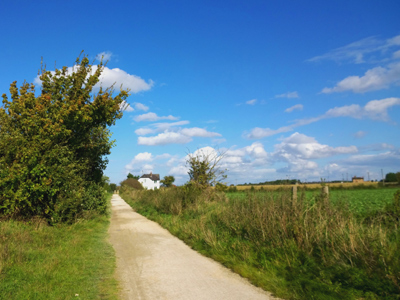
The colour of public foot paths on an Ordnance Survey map is green.
Map Skills 2
This quiz builds your map-reading muscles. You will practise using scales, grid references, and symbols to find places quickly and accurately.
1 .
What are the grid references at the bottom of a map called?
Northings
Southings
Eastings
Westings
They travel from West to East
2 .
What symbol is used to represent a tourist information centre?
Letters TI
Small i in a box
Small ti in a box
Letter I
Tourist information centres are useful if you are somewhere you do not know your way around
3 .
Which scale shows the most detail on a map?
1:500,000
1:25,000
1:250,000
1:50,000
The lower the ratio the more detailed the map
4 .
What is represented by the symbol of a P in a box?
Car Park
Post Office
Police Station
Palace
A letter P outside a box is a post office
5 .
If 1cm on a map is equal to 25,000cm on the ground, which scale represents this?
1:25
1:2,500
1:25,000
1:250,000
1:25,000 means that a cm on the map is 25,000 times longer in real life, so 1 cm on the map = 25,000 cm (250 m) in the real world
6 .
What are the grid references at the side of a map called?
Northings
Southings
Eastings
Westings
They travel from South to North
7 .
What colour are the tourist symbols on an Ordnance Survey map?
Blue
Green
Red
Black
Tourist symbols include theme parks, nature reserves, museums, castles and public toilets
8 .
What do contours represent on a map?
Lakes
Hills
Forests
Roads
Contour lines show land of equal height
9 .
If the contour lines are close together what does this mean?
It is a hill in a forest
It is a hill subject to flooding
The hill is not very steep
The hill is very steep
The closer the lines the steeper the hill
10 .
What colour are the public footpaths on an Ordnance Survey map?
Blue
Green
Red
Black
Motorways are blue, A-roads are red and B-roads are yellow


**Unlimited Quizzes Await You! 🚀**
Hey there, quiz champ! 🌟 You've already tackled today's free questions.
Ready for more?
Ready for more?
🔓 Unlock UNLIMITED Quizzes and challenge yourself every day. But that's
not all...
not all...
🔥 As a Subscriber you can join our thrilling "Daily Streak" against other
quizzers. Try to win a coveted spot on our Hall of Fame Page.
quizzers. Try to win a coveted spot on our Hall of Fame Page.
Don't miss out! Join us now and keep the fun rolling. 🎉
**Unlimited Quizzes Await You! 🚀**
Hey there, quiz champ! 🌟 You've already tackled today's free questions. Ready for more?
🔓 Unlock UNLIMITED Quizzes and challenge yourself every day. But that's not all...
🔥 As a Subscriber you can join our thrilling "Daily Streak" against other quizzers. Try to win a coveted spot on our Hall of Fame Page.
Don't miss out! Join us now and keep the fun rolling. 🎉
© Copyright 2016-2026 - Education Quizzes
Work Innovate Ltd - Design | Development |
Marketing