


Ask the AI Tutor
Need help with Guide Quiz - Navigation And Map Reading? Ask our AI Tutor!
AI Tutor - Lucy
Connecting with Tutor...
Please wait while we establish connection
Topographical maps are used regularly they show terrain features, woodland, elevation, water features etc.
Guide Quiz - Navigation And Map Reading
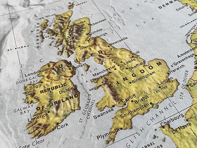
Learn navigation and map reading with Guides, from directions and routes to understanding how maps help people find their way.
1 .
What is the purpose of a compass when navigating?
To measure distance
To point to magnetic north
To identify landmarks
To estimate time
A compass always points to north, which helps you orient yourself on a map and navigate your way in the outdoors.
2 .
What does the contour line on a map represent?
Roads
Water features
Forests
Changes in elevation
Contour lines show the height and shape of the land. Tip: the closer the lines the steeper the terrain.
3 .
On an Ordnance Survey Map, what symbol represents a church with a tower?
A small triangle
A cross
A small square with a cross on top
A dot
Churches with towers are marked by a square with a cross on top, while churches with spires have a different symbol.
4 .
Which direction do you need to travel if you want to move from grid reference GR 340470 to GR 345470?
East
West
North
South
The second set of numbers indicates movement across the map from west to east aka, grid eastings.
5 .
If you're following a bearing of 180 degrees, which direction are you heading?
North
East
West
South
A bearing of 180 degrees points you directly south, while 0 or 360 is north.
6 .
What is the scale of an Ordnance Survey Explorer map commonly used hiking?
1:10,000
1:25,000
1:50,000
1:100,000
A 1:25,000 scale map means 1cm on the map equals 250 meters on the ground, ideal for detailed navigation while hiking.
7 .
What is the name of the symbol on a map that indicates the direction of north?
North pointer
Arrow of navigation
Northing indicator
North compass rose
The north compass rose is usually located at the corner of a map and shows the direction of true north.
8 .
How many meters is each square on a 1:25,000 Ordnance Survey map grid?
1 meter
100 meter
500 meter
1 kilometre
Each square on a map grid covers an area of 100 meters by 100 meters, which helps you calculate distances easily.
9 .
Which map feature would help you identify a waterway flowing from higher to lower ground?
Grid references
Spot heights
Blue lines
Contour lines
Waterways usually flow from higher to lower ground, and by following the contour lines, you can trace the water's direction.
10 .
When taking a bearing from a map using a compass, what should you do after aligning the compass with the map's grid?
Look at the distance scale
Rotate the map
Adjust for magnetic declination
Follow the needle's direction
Magnetic declination is the difference between magnetic north and true north, which you need to adjust for accurate navigation.


**Unlimited Quizzes Await You! 🚀**
Hey there, quiz champ! 🌟 You've already tackled today's free questions.
Ready for more?
Ready for more?
🔓 Unlock UNLIMITED Quizzes and challenge yourself every day. But that's
not all...
not all...
🔥 As a Subscriber you can join our thrilling "Daily Streak" against other
quizzers. Try to win a coveted spot on our Hall of Fame Page.
quizzers. Try to win a coveted spot on our Hall of Fame Page.
Don't miss out! Join us now and keep the fun rolling. 🎉
**Unlimited Quizzes Await You! 🚀**
Hey there, quiz champ! 🌟 You've already tackled today's free questions. Ready for more?
🔓 Unlock UNLIMITED Quizzes and challenge yourself every day. But that's not all...
🔥 As a Subscriber you can join our thrilling "Daily Streak" against other quizzers. Try to win a coveted spot on our Hall of Fame Page.
Don't miss out! Join us now and keep the fun rolling. 🎉
© Copyright 2016-2026 - Education Quizzes
Work Innovate Ltd - Design | Development |
Marketing