


Ask the AI Tutor
Need help with What is a River?? Ask our AI Tutor!
AI Tutor - Lucy
Connecting with Tutor...
Please wait while we establish connection
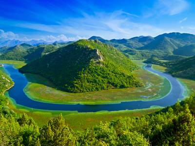
The landscape is shaped by rivers.
What is a River?
In this GCSE Geography quiz you will explore what rivers are, how they flow from source to mouth, and how they help shape the landscape.
1 .
Rivers are surrounded by their drainage basins. What is a drainage basin?
The area into which the water from the river drains into the groundwater
The area in which cities discharge sewage and waste into a particular river
The area of land drained by a river and its tributaries
A valley between two mountain ranges
A river system is contained entirely within it's drainage basin
2 .
Most cities in the world are located on the banks of a major river, such as London on the Thames, Paris on the Seine, and Nottingham on the Trent. Which of the following is not a reason for cities to be built on the banks of a major river?
Transport and shipping routes
Farming on the flood plains
The river could be used as protection against invading forces
Reduced risk of flooding
The Romans located most of their forts on rivers. This brought many advantages - they could use the river as a defensive structure, bring ships up and down for transport, ford or bridge the river at that point and farm the fertile land there. But one disadvantage was that the forts and cities were often flooded
3 .
River discharge is the amount of water flowing through a river channel. How is river discharge measured?
Cubic metres per second (cumecs)
Litres
Pounds per square inch (PSI)
Litres per hour
Rivers discharge a large amount of liquid every second, so the measurement has to be of a large enough scale to cope with that
4 .
In the Victorian era many rivers were culverted to hide the polluted waters and provide more land. What is a culvert?
A tunnel carrying a stream, river or open drain
A hole dug to send a river underground
Where water has dissolved limestone and formed an underground channel
A canal to divert water around cities and towns
Culverts often started as a series of bridges over rivers. These were joined together and buildings built over them, until the river disappeared entirely
5 .
The water cycle is also known as what?
The carbon cycle
Precipitation
Flooding
The hydrological cycle
The water cycle, hydrological cycle or the H2O cycle, all mean the same. They all describe the never ending movement of water on, above and below the surface of the Earth, in rivers, clouds, oceans, lakes, organisms and groundwater
6 .
What is a freshwater river?
Water held in one position for the purpose of water supply
A body of water that is prone to floods and drought
Anything larger than a stream, but smaller than a lake
Water low in salt content flowing across the surface of the land, usually towards the sea
Rivers move from the mountains to the sea. Freshwater has less salt dissolved in it than sea water
7 .
In physical geography how is the watershed defined?
The imaginary line separating two drainage basins. This is normally a ridge of higher ground that divides two river valleys or other drainage basins
A straight line drawn between two high peaks
The area connecting two river sources
A line created by connecting all the sources of a particular river
Think of the watershed as being the line where if you poured water onto the ground it could go one way or another
8 .
At its end the River Nile has numerous channels carrying water away from the main channel. What is the name given to this type of estuary?
Mouth
Delta
Distributaries
Convoluted
The Nile and Mississippi are both famous examples of this type of estuary
9 .
Tributaries and distributaries both carry water, but what is the key difference between these two types of channel and how they are defined?
Tributaries flow into a river, carrying water into the main channel, whilst distributaries split off and carry water away from the main channel
Tributaries only occur in the upper reaches of a river, whilst distributaries only occur in the lower reaches
Tributaries are streams, whilst distributaries are rivers
Tributaries are the erosive areas of a river system, whilst distributaries are the land building sections of the river system
When you're learning new words, try and think what the words mean. A tribute is when you give something to someone, and if you distribute something you are taking it away and giving it out in smaller amounts
10 .
In the 1860s Dr. Livingston was almost lost in Africa searching for the source of the River Nile. Why are river sources so difficult to find?
The source of a river may be underground
They have often been built over by later housing and industrial developments
A river can have hundreds of tributaries. The source is the head of the tributary furthest away from the mouth of the river. Rivers like the Nile have tributaries over thousands of square miles all of which have to be measured to determine which is the furthest away
They are very small and difficult to find in the landscape
Drainage basins can be huge, especially on rivers like the Nile and Amazon. Finding which of the tributaries is the source can be difficult


**Unlimited Quizzes Await You! 🚀**
Hey there, quiz champ! 🌟 You've already tackled today's free questions.
Ready for more?
Ready for more?
🔓 Unlock UNLIMITED Quizzes and challenge yourself every day. But that's
not all...
not all...
🔥 As a Subscriber you can join our thrilling "Daily Streak" against other
quizzers. Try to win a coveted spot on our Hall of Fame Page.
quizzers. Try to win a coveted spot on our Hall of Fame Page.
Don't miss out! Join us now and keep the fun rolling. 🎉
**Unlimited Quizzes Await You! 🚀**
Hey there, quiz champ! 🌟 You've already tackled today's free questions. Ready for more?
🔓 Unlock UNLIMITED Quizzes and challenge yourself every day. But that's not all...
🔥 As a Subscriber you can join our thrilling "Daily Streak" against other quizzers. Try to win a coveted spot on our Hall of Fame Page.
Don't miss out! Join us now and keep the fun rolling. 🎉
© Copyright 2016-2026 - Education Quizzes
Work Innovate Ltd - Design | Development |
Marketing