


Ask the AI Tutor
Need help with Geography Skills 01? Ask our AI Tutor!
AI Tutor - Lucy
Connecting with Tutor...
Please wait while we establish connection
Latitude lines on an atlas map run from east to west.
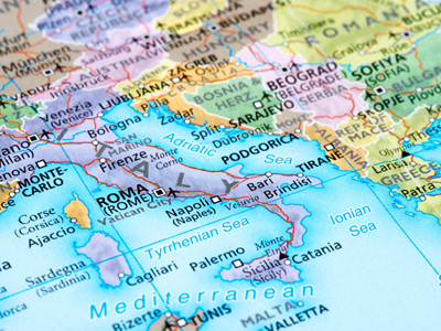
Geography Skills 01
Good geographers use skills such as reading maps, interpreting graphs and using compass directions to make sense of places, journeys and patterns around the world.
1 .
A line on a scatter graph showing the general relationship is called what?
Line of best fit
Line of least resistance
Trend marker
Z axis
It does not have to go through all points on the graph
2 .
Which of these sets of ranges is best for a choropleth map key?
0-2, 3-8, 9-17
0-3, 3-10, 10-11
0-4, 5-9, 10-14
0-5, 5-10, 10-15
Ranges of equal size that do not overlap
3 .
What sort of map uses colour shading?
Choropleth map
Dot map
Pictogram
Proportional symbol map
Useful for showing data for different areas
4 .
Which graph is best for showing continuous data?
Line graph
Pictograph
Pie graph
Vertical bar graph
Continuous data has no clear-cut breaks between the values e.g. temperature figures
5 .
On an O.S. map, contour lines are what colour?
Black
Blue
Brown
Green
They show the height above mean sea level
6 .
A map often includes an arrow pointing where?
East
North
South
West
On O.S. maps, north is at the top
7 .
Which graph would not be used to show data that adds up to 100%?
Block graph
Divided bar graph
Pie graph
Vertical bar graph
It is important to choose the correct type of graph otherwise the data will not be displayed correctly
8 .
What does 'O.S.' stand for in O.S. maps?
Ordinary Scale
Ordnance Survey
Outdoor Scan
Over Sized
It's a Government department providing maps of Britain
9 .
A line from east-west on an atlas map is a line of what?
Latitude
Longitude
Meridian
Reference
The British Isles cover approximately 10 degrees of latitude
10 .
To give a 6 figure grid reference we imagine the map square is divided into what fraction?
10ths
20ths
5ths
8ths
With experience, a 6 figure grid reference can pinpoint something to within a few metres of its actual position


**Unlimited Quizzes Await You! 🚀**
Hey there, quiz champ! 🌟 You've already tackled today's free questions.
Ready for more?
Ready for more?
🔓 Unlock UNLIMITED Quizzes and challenge yourself every day. But that's
not all...
not all...
🔥 As a Subscriber you can join our thrilling "Daily Streak" against other
quizzers. Try to win a coveted spot on our Hall of Fame Page.
quizzers. Try to win a coveted spot on our Hall of Fame Page.
Don't miss out! Join us now and keep the fun rolling. 🎉
**Unlimited Quizzes Await You! 🚀**
Hey there, quiz champ! 🌟 You've already tackled today's free questions. Ready for more?
🔓 Unlock UNLIMITED Quizzes and challenge yourself every day. But that's not all...
🔥 As a Subscriber you can join our thrilling "Daily Streak" against other quizzers. Try to win a coveted spot on our Hall of Fame Page.
Don't miss out! Join us now and keep the fun rolling. 🎉
© Copyright 2016-2026 - Education Quizzes
Work Innovate Ltd - Design | Development |
Marketing